

28.05.2025
3 minutes of reading


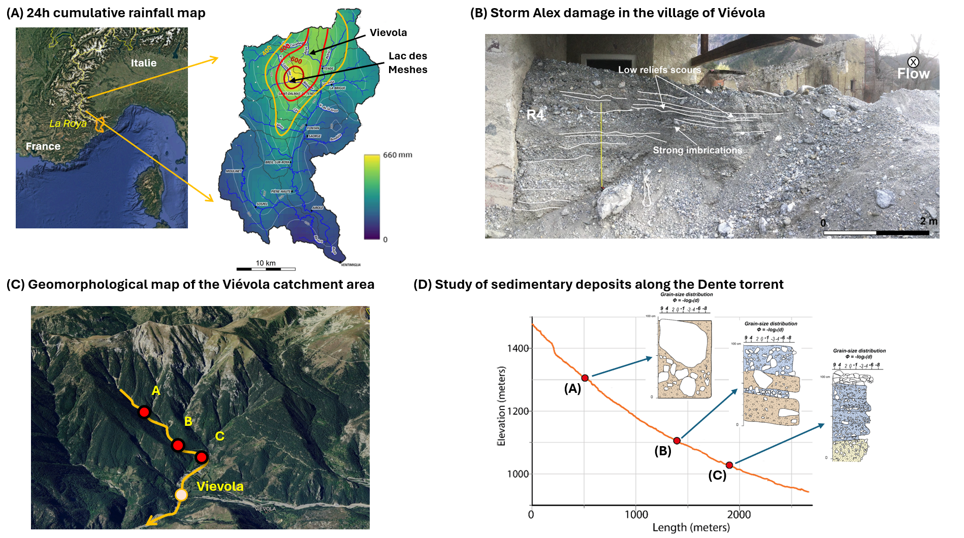
The Tinée, Vésubie and Roya valleys in south-east France were exposed to the full force of storm Alex on 2 and 3 October 2020. This storm was triggered by a fast-developing low-pressure system over the Atlantic, which came into contact with a mass of warm, moist air from the Mediterranean, causing unprecedented rainfall in the hinterland of the Alpes-Maritimes region. In the Roya valley, the highest cumulative rainfall in 24 hours was recorded at the Mesches dam, with around 663 mm (Fig. 1A). This extreme weather event caused major geomorphological changes to the River Roya and the surrounding slopes, resulting in sedimentary deposits along its course of more than 2 meters in places.
IFPEN and Sorbonne University conduct research at the site of the disaster
In order to understand and model the impact of extreme hydro-sedimentary events on slope stability and erosion, and on the dynamics of torrential water and sediment flows, a geological and numerical study of the Viévola valley1, one of the tributaries of the Roya, was conducted by IFPEN and Sorbonne University. This valley is characterized by very steep gradients, in excess of 50°, and sparse plant cover. There were two components to the study: (1) characterization of landslides [1] and sedimentary deposits (Figure 1, [2]) caused by Storm Alex, (2) numerical hydro-sedimentary modeling and slope stability calculations (Figure 2).
1 A smaller valley, enabling a more comprehensive study
Sedimentary deposits containing a wealth of information about the impact of storm Alex
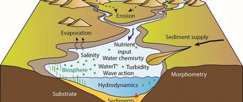
This study began with an examination of the sedimentary deposits caused by Storm Alex in the Viévola valley, focusing first on the village of Viévola (Figure 1 B), before moving upstream along the Dente torrent above the village (Figure 1C and D), in order to characterize the sedimentary facies of the deposits and deduce the hydraulic processes that generated them. The main factors governing sediment transport are slope, particle size and sediment cohesion, determining how it is transported: suspended in the water, drawn or carried in debris flows.
Landslide identification and calculation of volumes of debris transported
This was followed by a morphological analysis of the slopes of the Viévola valley. Aerial and satellite images and digital surface models acquired by IGN (French National Institute of Geographic and Forest Information) in 2020 (prior to the storm) and 2021 (after the storm) were used to identify landslide areas. Topographic surveys in the field were conducted to characterize the vegetation cover, correct the surface models and derive digital terrain models (DTMs), representing the altitude of bare ground, with no vegetation or dwellings. The difference between the 2021 and 2020 DTMs enabled us to quantify the average depth of the landslides - around 1.7 m -, and the volumes eroded and exported from the Viévola valley to the Roya - around 180,000 m3 (Kerverdo et al., 2024).
Major role of the Viévola catchment area
The study then highlighted the key role of the Viévola catchment area as a major source of sediment, with a particular contribution from the headwaters of the Dente and Rabay torrents. Erosion during this extreme storm was more pronounced in areas characterized by scree and fluvio-glacial deposits, which were torn away during the storm and carried down the Viévola valley, where they engulfed part of the village with some even transported to the Roya.
These results have provided valuable information about the geomorphological reaction of slopes and rivers to extreme events, and have furthered our understanding of the predisposing factors conducive to the triggering of major hydro-sedimentary events.
Numerical simulation of erosion and transport processes
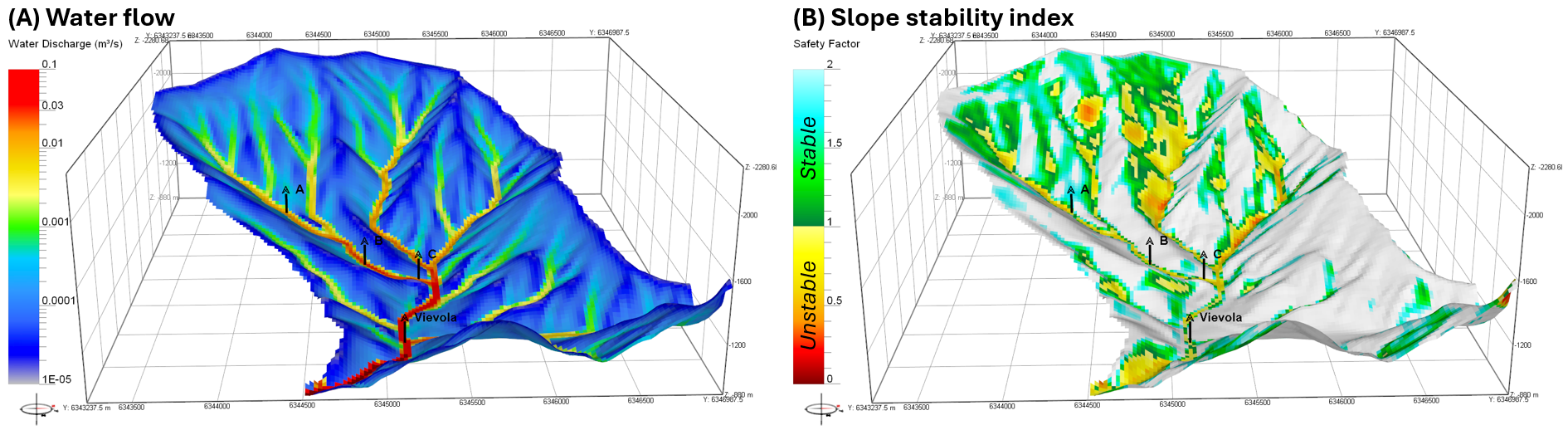
Work is ongoing to numerically reproduce the processes of slope erosion and sediment transport in rivers. Initial hydro-sedimentary modeling using the ArcaDES/DionisosFlow® model enabled simulation of water flow during the storm with a view to quantifying the flow rate, height and velocity (Figure 2a). It was then possible to deduce a slope stability factor using a geomechanical model. Ultimately, this global hydro-sedimentary characterization and modeling approach will make it possible to simulate extreme events, evaluate uncertainties and risks, and consequently provide an assessment of an area's vulnerability to climate change.
References:
[1] Kerverdo, R., Lafuerza, S., Gorini, C., Rabaute, A., Granjeon, D., Deschamps, R., Fouache, E., Jafari, M., Lagree, P.Y., 2024. The impact of storm Alex on the Vievola catchment: a quantitative analysis of sediment volume and morphological changes in the Roya river tributaries. Landslides,
>> DOI : https://doi.org/10.1007/s10346-024-02361-2
[2] Kerverdo, R., Lafuerza, S., Gorini, C., Fouache, E., Rubino, J.-L., Granjeon, D., Deschamps, R., Jafari, M., Lagrée, P.-Y., and Bianchi, N., 2025. Extreme flood event and their depositional signatures: the case of the Storm Alex in the Roya Valley, EGU General Assembly 2025.,
>> DOI : https://doi.org/10.5194/egusphere-egu25-17785
Scientific contact: Didier Granjeon, Rémy Deschamps, Raphael Kerverdo
You may also be interested in
Knowledge and description of sedimentary systems
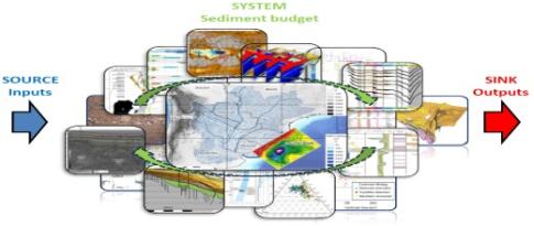
Sedimentary budgets: concept, methods and integration in basin analysis on a land-sea continuum In a given sediment compartment , the sedimentary budget consists in evaluating sedimentary inputs, transfers and exports, and equating them to the net gain or loss over a specified period of time Sedimentary budgets are very widely used in geosciences. when integrated on a larger scale, they offer the possibility of acquiring a global vision of sedimentary systems.
Natural gas in marine sediments: a climate issue?
Just like carbon dioxide (CO2), but with a much higher GWPa, methane CH4) is a gas which, according to the IEAb, is responsible for around 30% of the increase in global temperatures since the industrial revolution...
Lacustrine sedimentary series: an archive of past environmental changes to better understand the present
THESIS BYALEXANDRE LETTÉRON