



Air pollution remains a major public health issue, particularly in large metropolitan areas, despite the gradual renewal of the vehicle fleet and the development of active mobility solutions, thanks to dedicated urban infrastructure. New European limit values for pollutant concentrations in the air, more closely aligned with WHO recommendations1, will take effect in 2030. Local authorities therefore need tools capable of assessing pollution levels and sources in order to support pollution reduction scenarios.
Such tools do exist, but they struggle to capture the high variability of pollution at a local level (at the scale of individual streets, for example). The fact is that emissions vary not only with traffic but also with rapidly changing weather conditions. Buildings also alter airflow locally. Therefore, while monitoring stations are essential, they alone cannot capture this variability across an entire metropolitan area.
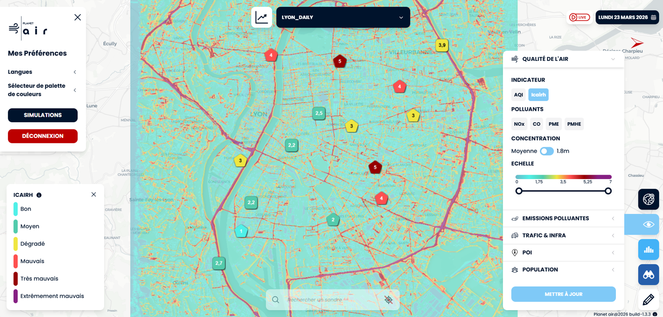
IFPEN has developed a comprehensive methodology that integrates modeling of atmospheric pollutant dispersion with real-world data, including meteorological measurements, road traffic emissions, and urban morphology. The model's results were then compared with observational air quality data. The resulting tool is deployed via a SaaS platform: PLANET’AIR [1]. This tool generates high-resolution hourly maps of air pollution and allows users to determine concentrations at any location using “virtual sensors,” while also enabling comparisons betweenvarious mobility or land-use scenarios.
This approach was thoroughly evaluated in the Lyon metropolitan area (figure 1), with validation against data from various monitoring stations, over several days and covering a range of weather and traffic conditions. The results confirm the benefits of this approach, which allows for precise estimates of population exposure levels, underlining the importance of taking into account:
- emissions data with high spatial and temporal resolution [2];
- local weather conditions;
- the geometric complexity of buildings, which can either channel or obstruct airflow.
PLANET’AIR paves the way for a more precise assessment of population exposure. By helping to identify the factors that influence air quality, the platform provides local stakeholders with quantitative data to prioritize their prevention and mitigation efforts.
These developments have been supported by several publicly funded collaborative projects:
OLGA — Horizon 2020 Program / European Green Deal
MAGPIE — Horizon 2020 Program / European Green Deal
SPARC — ADEME – ADEIP
RTAMS — ANR – PREMAT
AMELIA — DIAT / Caisse des Dépôts et Consignations (CDC)
1 European air quality directive UE2024/2881
References:
[2] Sabiron, G., Jay, S., Agelas, L., Speirs, E., Feng, G., and Bussod, S., "From Road Traffic to Virtual Air Quality Sensors: PLANET'AIR - An Integrated Mesoscopic Modelling Framework", in Proceedings of TAP 2025 (Transport and Air Pollution), 2025.
[2] Bussod S., and Sabiron G., “Deep learning-based method for an assessment of road traffic pollutant estimation from predicted driving behaviors», IEEE International Conference on Machine Learning and Applications (ICMLA), Miami, FL, USA, 2024, pp. 658-663,
>> DOI : https://doi.org/10.1109/ICMLA61862.2024.00095
Scientific contact: Guillaume Sabiron